Where in Russia does the Urals region end and Siberia begin?

Siberia is regarded as beginning just beyond the Ural Mountains, but there is a city in the southern Urals that literally stands on the site of a geological fault. On one side are the geological strata of the Trans-Ural Plain and, on the other, those of the West Siberian Plain. And between them is a river.

A bridge to Siberia
Although the major Russian city of Chelyabinsk (1.2 million population) is regarded as being in the Urals, it is, in fact, located on a geological fault right on the border between the Urals and Siberia. The River Miass, which passes through its center, practically divides the city in half. The left bank of the river is in the Urals, while the right bank belongs to Siberia.

The Leningradsky Bridge across the Miass in the center of town is the very place where one can get from the Urals to Siberia in five minutes. It is a road bridge, as well as a crossing for pedestrians.
Truda Street, which was called Sibirskaya Street until 1920, since it did, in fact, lead to Siberia, runs along the river (on the right-hand side).
The fact that the two banks belong to different geological structures is evident even to the naked eye.

Another border crossing point in the city is on Lenina Avenue not far from the Chelyabinsk Tractor Plant Museum. Identical ‘Siberia-Urals’ monuments, placed opposite each other, can be seen on either side of the avenue.

Designed by Urals architect Sergei Shumakov, they were erected fairly recently in 2014.
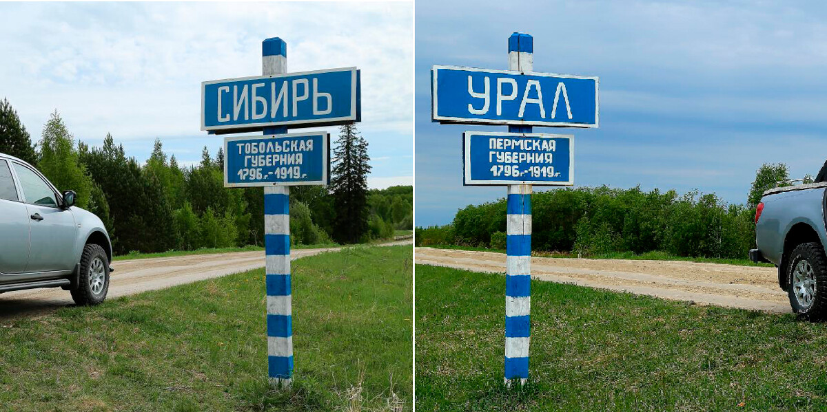
Boundary marker on the River Mezhnitsa

Another marker showing the hypothetical border between the Urals and Siberia is by the bridge over the River Mezhnitsa on the Irbit-Tyumen road. In the Russian Empire, this bridge was regarded as the official boundary between the Urals (Perm Governorate) and Siberia (Tobolsk Governorate). It is 16 kilometers from there to the nearest center of habitation - the village of Melnikova (Sverdlovsk Region).


