How to use the Moscow Metro (PHOTOS+INFOGRAPHICS)
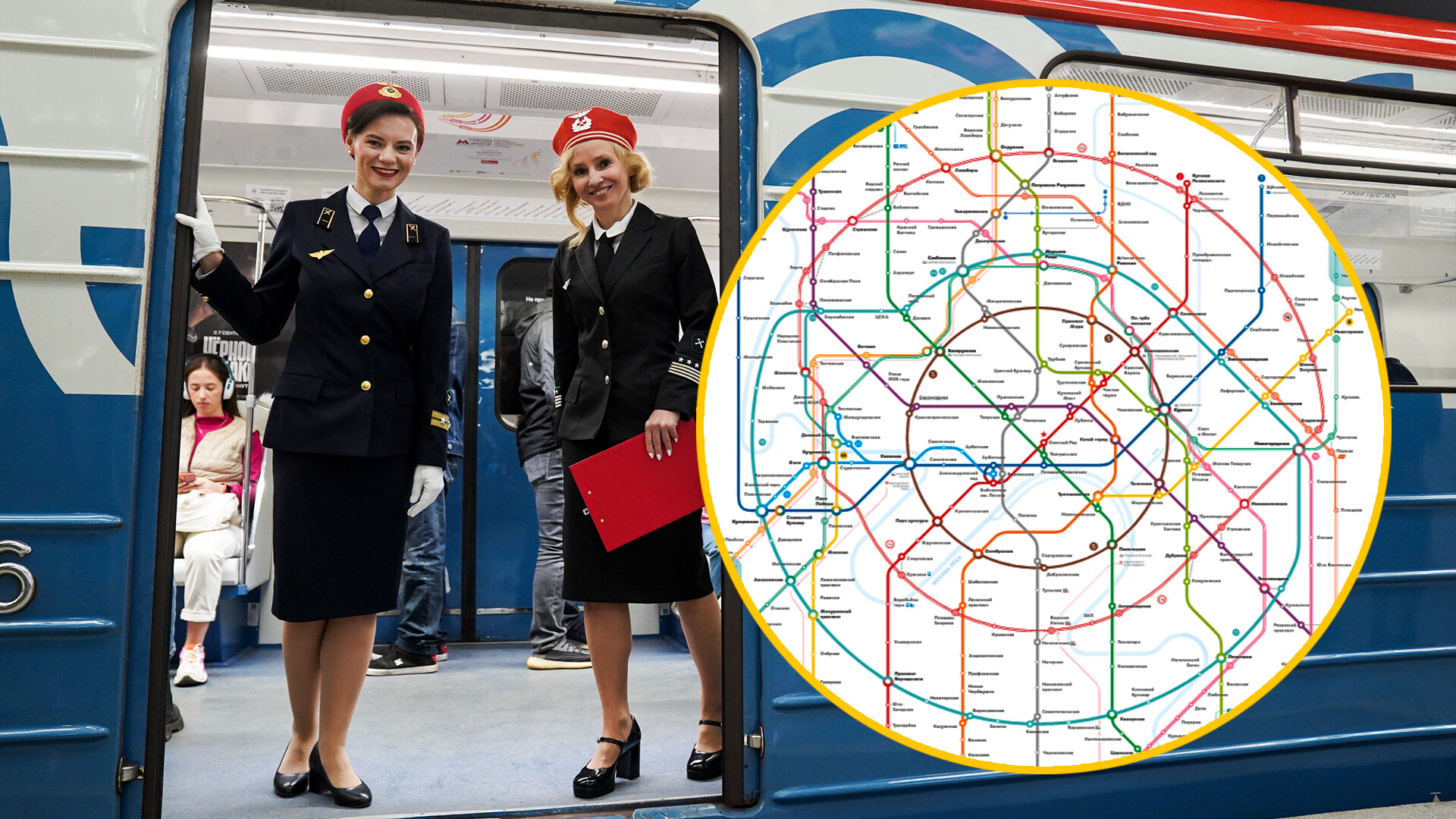
It’s really convenient to use the Moscow Metro and city trains. They operate from 5:30 in the morning to 1:00 at night and you can pay for them with the same ‘Troika’ ticket card. Indeed, the map of the subway looks complex. But that’s only at first glance.
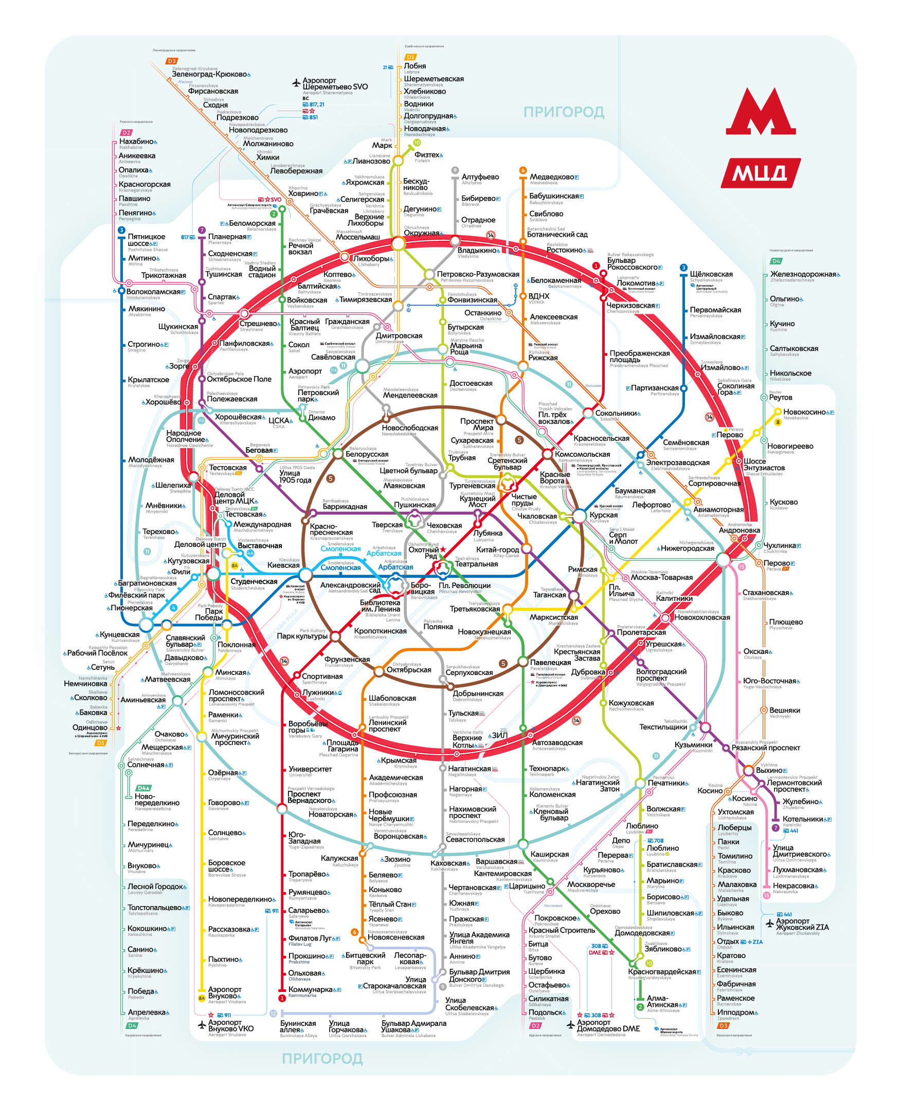
For starters, let’s separate the underground metro from surface city trains. The underground map is marked by bright solid lines, while the lines of surface routes are marked by two parallel lines with a white gap in between.
Underground metro system
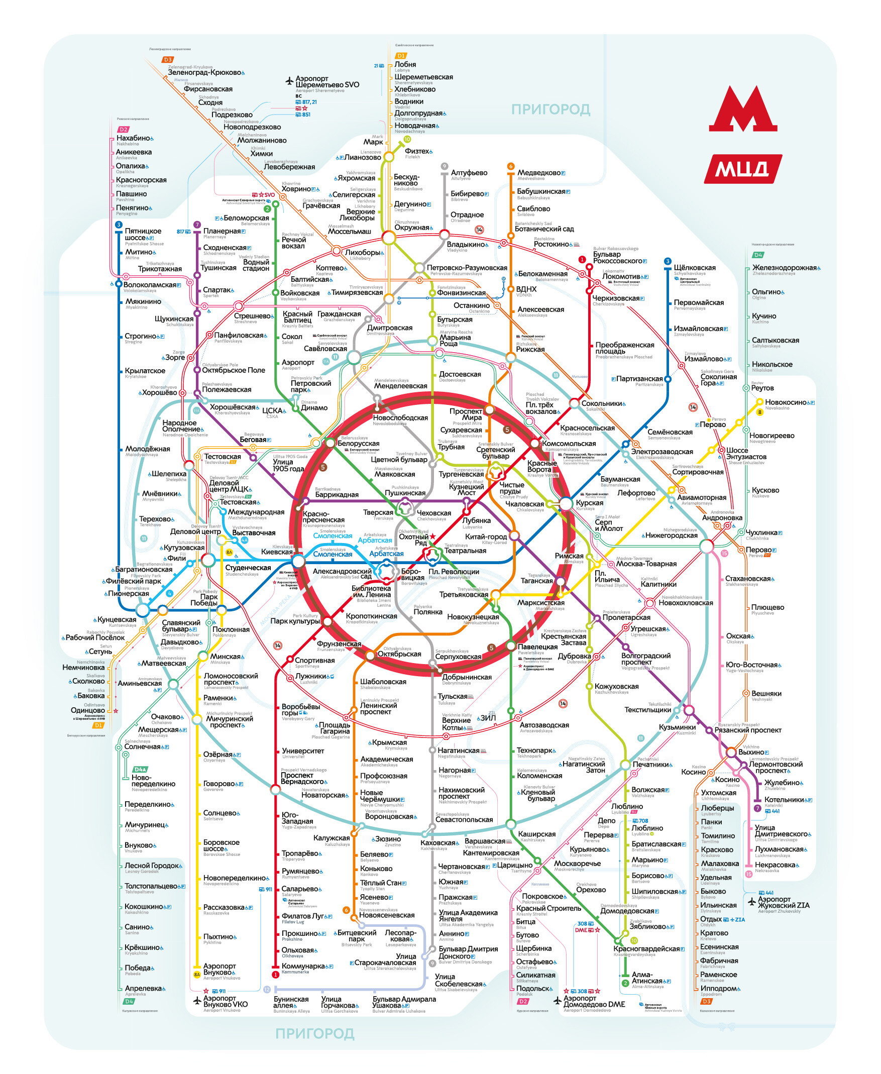
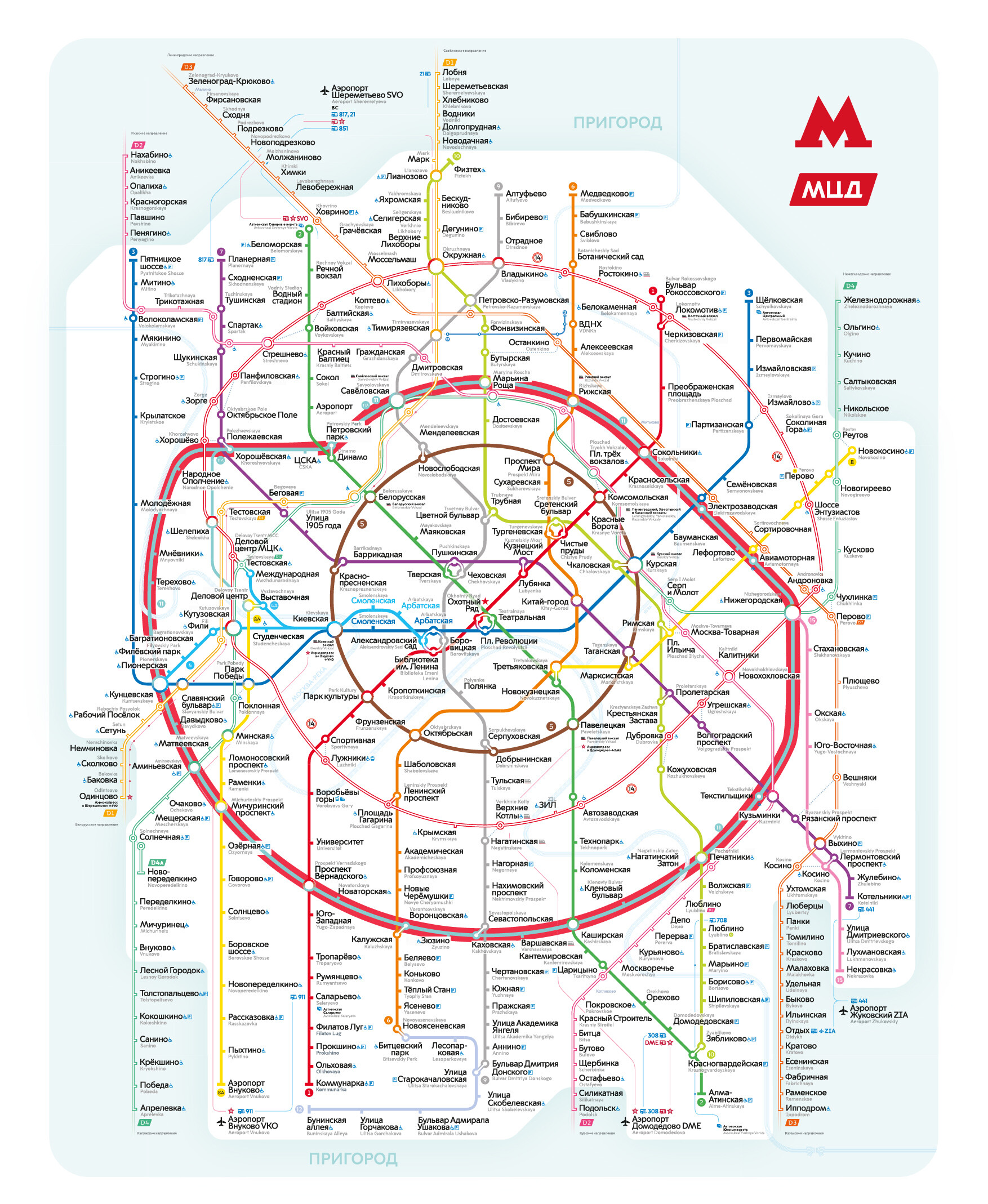
It has two ring lines – the brown Koltsevaya, or Circle line (5) and the new Bolshaya Koltsevaya line (Big Circle Line) colored turquoise (number 11). These rings cross all other underground metro lines, so if you need to reach another line from the outskirts – it’s convenient to use one of the ring lines.
 Circle Line
We can consider that the center of the city is inside of the ring line (5). Also there’s a multitude of transfers from one line to another within the brown ring. The record holder is Biblioteka Imeni Lenina – Arbatskaya – Alexandrovsky Sad – Borovitskaya. These whole four lines crossed in one place (right next to the Moscow Kremlin). Also, you can reach the Kremlin quickly and conveniently from stations Okhotny Ryad – Teatralnaya – Ploshchad Revolyutsii, which also have transfers between each other.
 Big Circle Line
You can also reach the Vnukovo Airport right by metro! The corresponding station of the Solntsevskaya Line (8A) was opened in September 2023.
How does the underground metro operate?
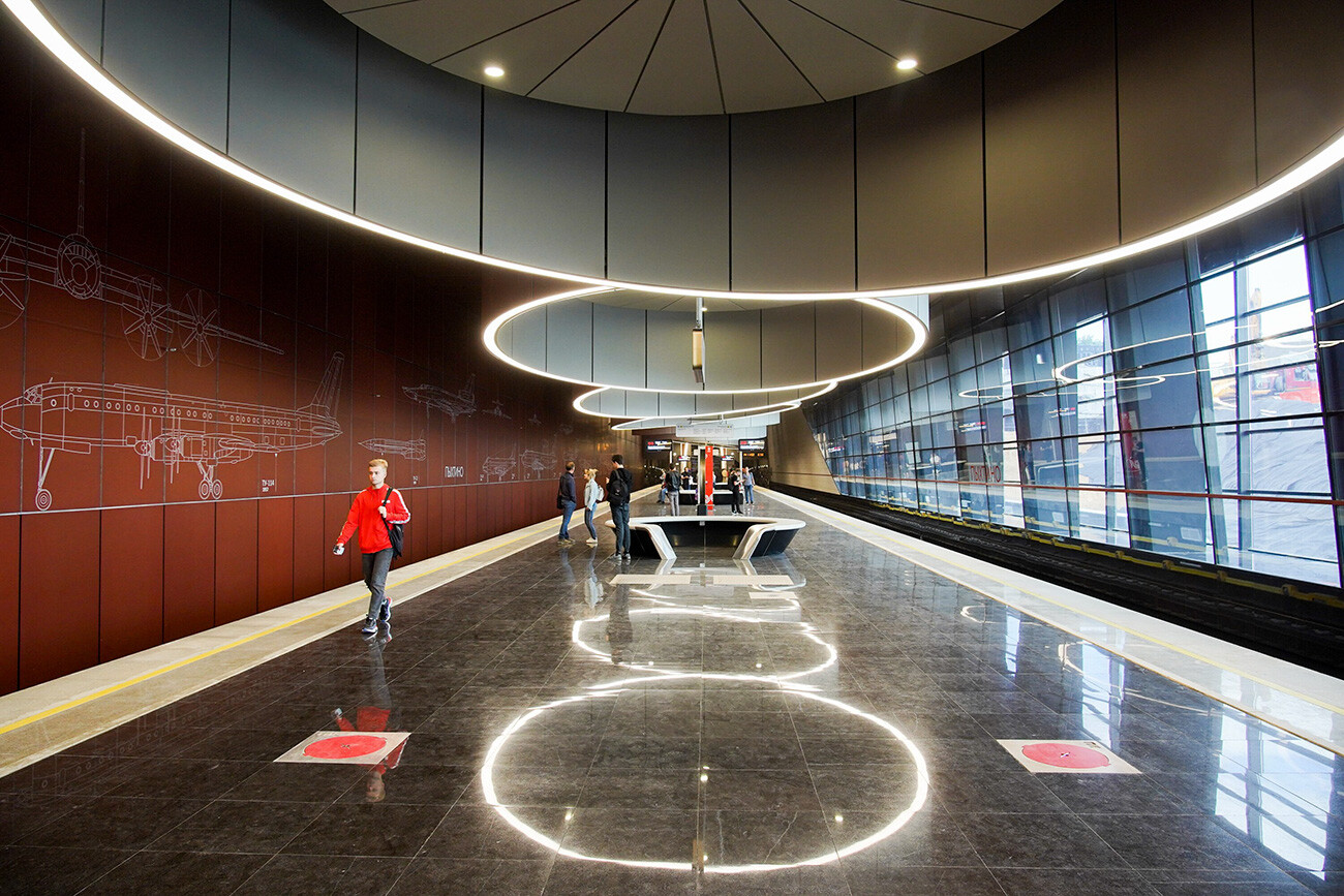 Pykhtino metro station, opened in 2023
The intervals between trains are really small – on average about 2 minutes; during rush hour, they run even more often. So you don’t need to run and squeeze yourself into closing doors (that’s also dangerous). Just wait for the next train, it’ll arrive quickly. Unlike the subway systems of other cities – the trains run along single lines, without branching away. So you can just board the train in the required direction without worrying that you will go somewhere you didn’t intend to.
There are only two exceptions:
- From Alexandrovsky Sad Station of the light-blue line trains run either to Mezhdunarodnaya Station (where Moscow City is located, where a lot of businessmen go) or to Pionerskaya.
- Bolshaya Koltsevaya line also has the so-called fork branching: from Savelovskaya Station to the Business Center (also to Moscow City).
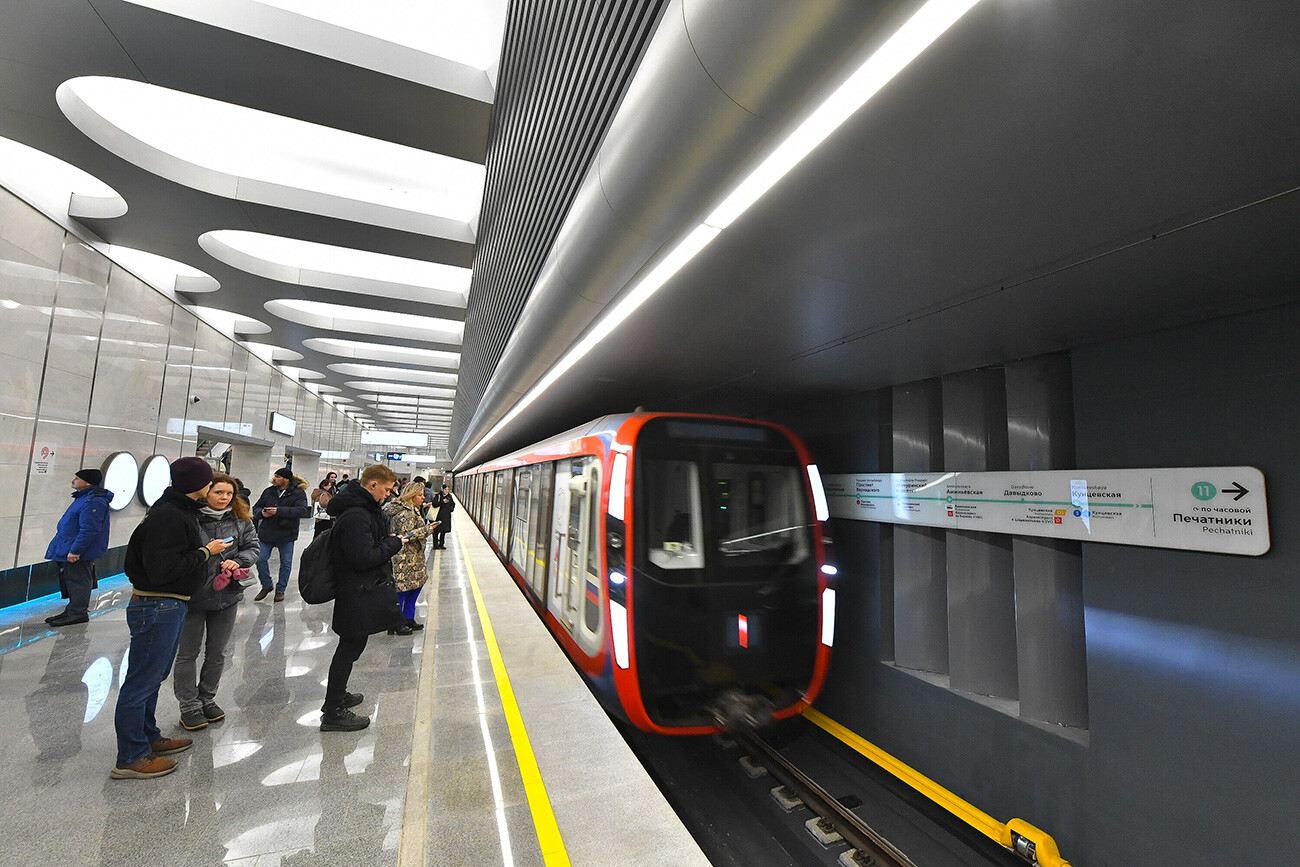 Big Circle Line
Sometimes you can hear an announcement ‘This train runs to the station…’ If you need to go further, you simply need to get off at the station the train is bound for, and wait for the next train. Perhaps, this train just needs to go to the depot.
Surface routes:
Apart from the underground metro itself, the new map marks suburban trains. You can tell them apart immediately – these lines are indicated with two parallel lines with a white gap in between.
1) MCC: Moscow Central Circle (14)
 Moscow Central Circle (MCC)
Let’s take a look at the map again and find a red circle, situated between the underground Koltsevaya (5) and Bolshaya Koltsevaya (11) lines. This is the Moscow Central Circle (14) or simply MCC.
This is a surface urban train that circles around the city. There are stations from where you can transfer to the underground metro. However, these transfers usually are not as short as between subway stations. Sometimes you’ll need about 10 minutes of walking to transfer.
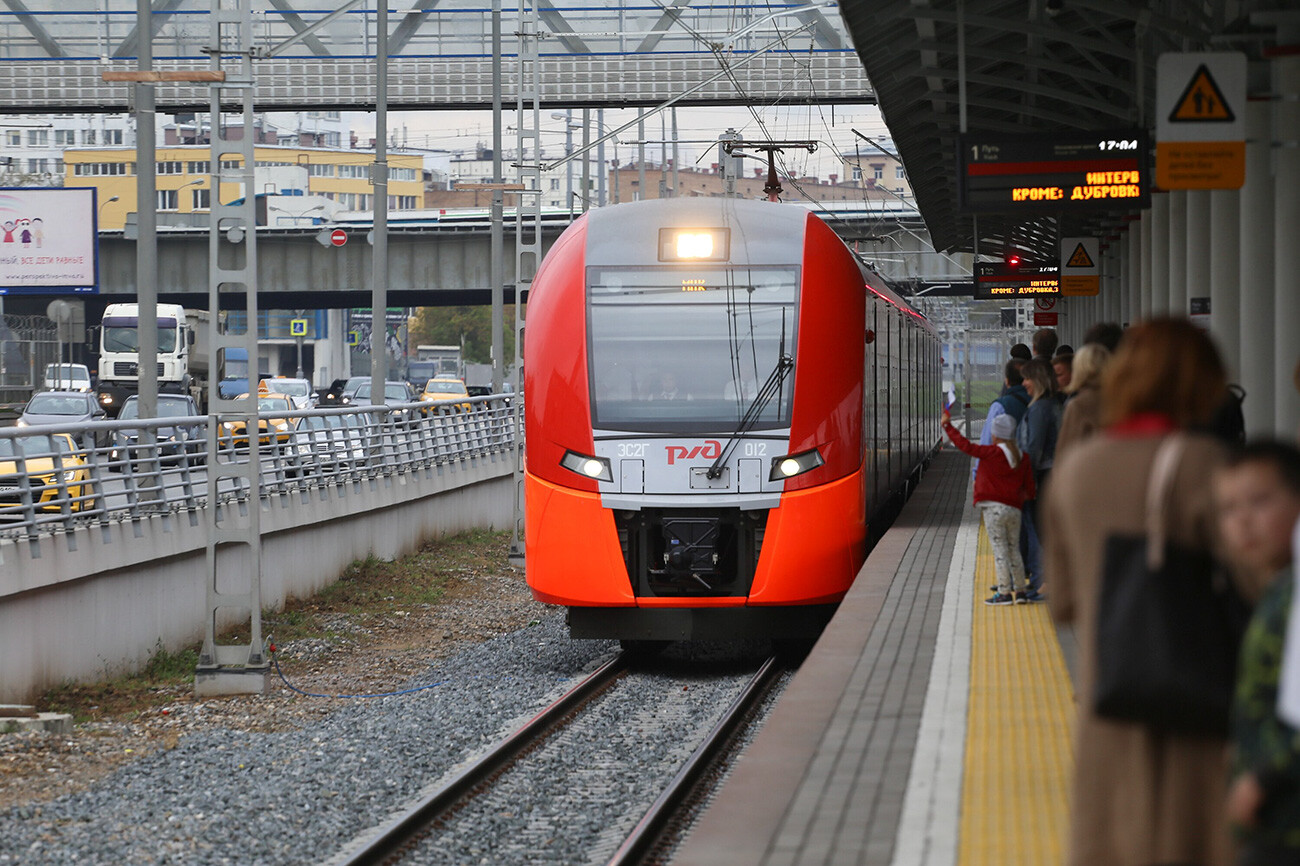 Moscow Central Circle (MCC)
So we don’t recommend you to use MCC purely as a transfer route. In addition, the interval between trains on MCC is longer than in the metro, and can reach 4-8 minutes, depending on the time of day.
However, a big advantage of the MCC is that it has a lot of stations that are far removed from the metro, and which are most conveniently reached specifically by the MCC.
2) Moscow Central Diameters (MCD)
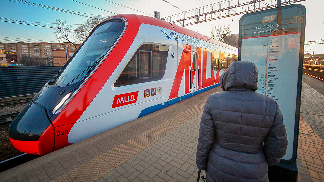 Moscow Central Diameters (MCD)
Moscow diameters on the metro map are the longest lines that cross the entire city (hence, they are called diameters). They are reminiscent of urban trains, like S-Bahn in Berlin or Vienna or RER in Paris.
Those are suburban train lines that run from suburbs (from the Moscow Region, marked as a green shadow on the map) and, crossing the entire city, are bound for suburbs on the other side of the city. At some of the stations of a diameter you can get off and transfer to the metro or the MCC. During rush hour, MCD trains run with an interval of 5-7 minutes.
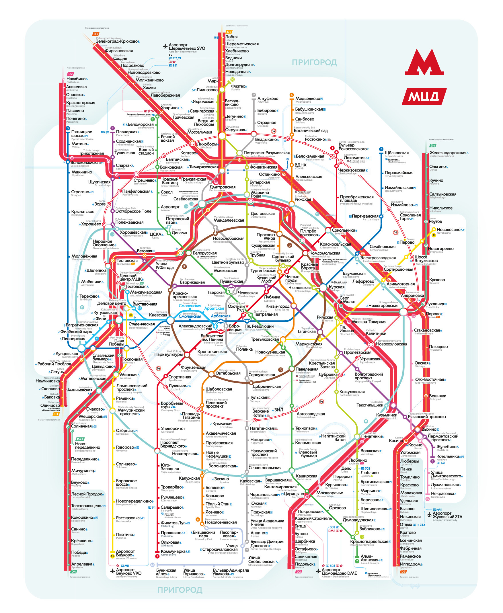 Moscow Central Diameters (MCD)
D1 – Belorussko-Savyolovsky Yellow Diameter runs from Odintsovo Station south-west from Moscow through Moscow City and Belorussky railway station to Sheremetyevo Airport and to Lobnya Station in the north.
D2 – Kursko-Rizhsky Pink Diameter runs from the Moscow Region city of Podolsk in the south through Kursky railway station, Three Station Square (Leningradsky, Kazansky, Yaroslavsky), and Rizhsky railway station to the village of Nakhabino in the north-west.
D3 – Leningradsko-Kazansky Orange Diameter runs from Ippodrom Station in the south-east (the city of Ramenskoye) to Zelenograd in the north.
D4 – Kaluzhsko-Nizhegorodsky Green Diameter runs from the city of Aprelevka in the south-west through Moscow City, Belorussky, Savelovsky, and Kursky railway stations, as well as through Three Station Square (Leningradsky, Kazansky, Yaroslavsky) to Zheleznodorozhnaya Station in the city of Balashikha in the east.
A fifth MCD line is also projected, which is promised to be finished by 2028. It will connect the south (Domodedovo) and the north (Pushkino).
3) Moscow Monorail
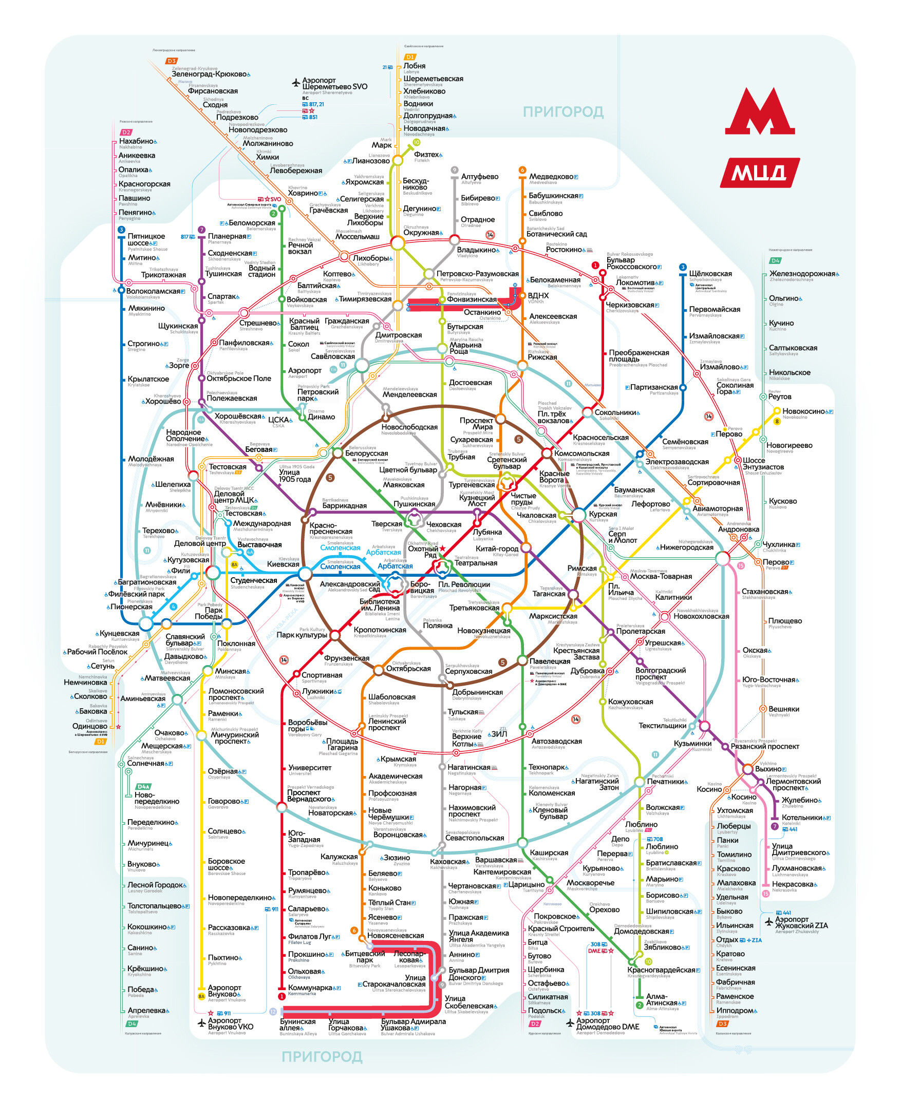 Moscow Monorail (highlighted above) and Light metro (bottom)
Look for the only monorail line in Russia to the north from the center of Moscow. It’s not just a surface line, it’s an elevated line that stands on piles. It’s a short line (13) that operates in an excursion mode – from it, you can get a beautiful view of the Ostankino TV Tower, for example.
Once per half an hour, the train runs from Timiryazevskaya Station (which is near the station of the same name on the Serpukhovsko-Timiryazevskaya (9) line, which is the gray metro line) to Ulitsa Sergeya Eisensteina Station, which is located next to the entrance to the VDNKh park and to the VDNKh metro station of the Kaluzhsko-Rizhskaya (6) metro line.
4) Light metro
Butovskaya (12) line in the south of Moscow runs from Buninskaya Alleya Station to Bitsevsky Park Station; from it, you can make a transfer to the gray Serpukhovsko-Timiryazevskaya (9) line and the orange Kaluzhsko-Rizhskaya (6) line. This line runs mostly on the surface, entering a tunnel, but is considered a part of the subway (hence, this line is marked with a solid line as other metro lines).
A useful piece of advice
The Moscow Metro website has an interactive map with all metro lines, MCC, and diameters. With it, you can build a route from the departure station to the destination station, take a look at all travel options and where you can make necessary transfers.
How to pay the fare
The convenience of the Moscow transportation system is that you only need the Troika card for travel with any type of public transport, be it the metro, suburban trains, or buses/trams. You can purchase it in ticket offices or from machines at stations. Also in souvenir shops and in the metro internet store you can purchase keychains, bracelets, and rings that work like a Troika card, as well as Troika cards with a unique and custom design.
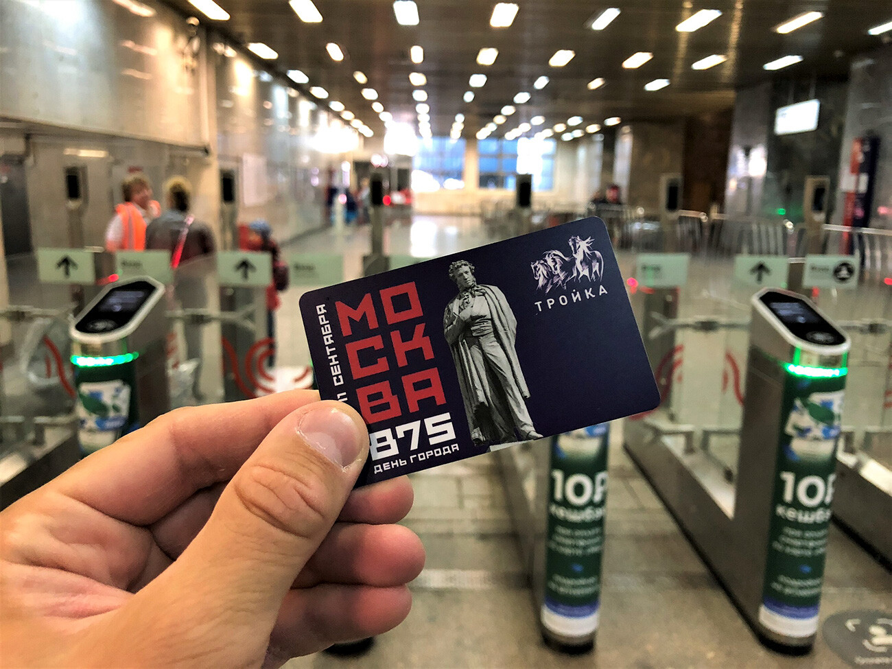 Troika design dedicated to the 875th anniversary of Moscow
You can top up your card by simply adding a particular amount of money – or purchase the Unified ticket for 60 travels or unified unlimited ticket for 1/3/30/90/365 days.
The deposit price of the Troika card is 80 rubles, and you can get it back when returning the card to the ticket office. The validity period of the card is 5 years, so you can save it for future travels.
One MCC, MCD (in the city center), and metro trip costs 54 rubles. Transfers in the metro, MCC, or between diameters are free within 90 minutes. The fare on MCD in the suburbs costs 71 rubles.
Important: you need to pay the fare in the metro and MCC only upon entrance. On diameters, you need to activate trips upon entrance and then tap your card again at the turnstile upon exiting.
Also almost every station has a terminal where you can pay your fare, tapping your bank card.

